Posts Tagged: Urban exploration
New London – Camp Mansfield
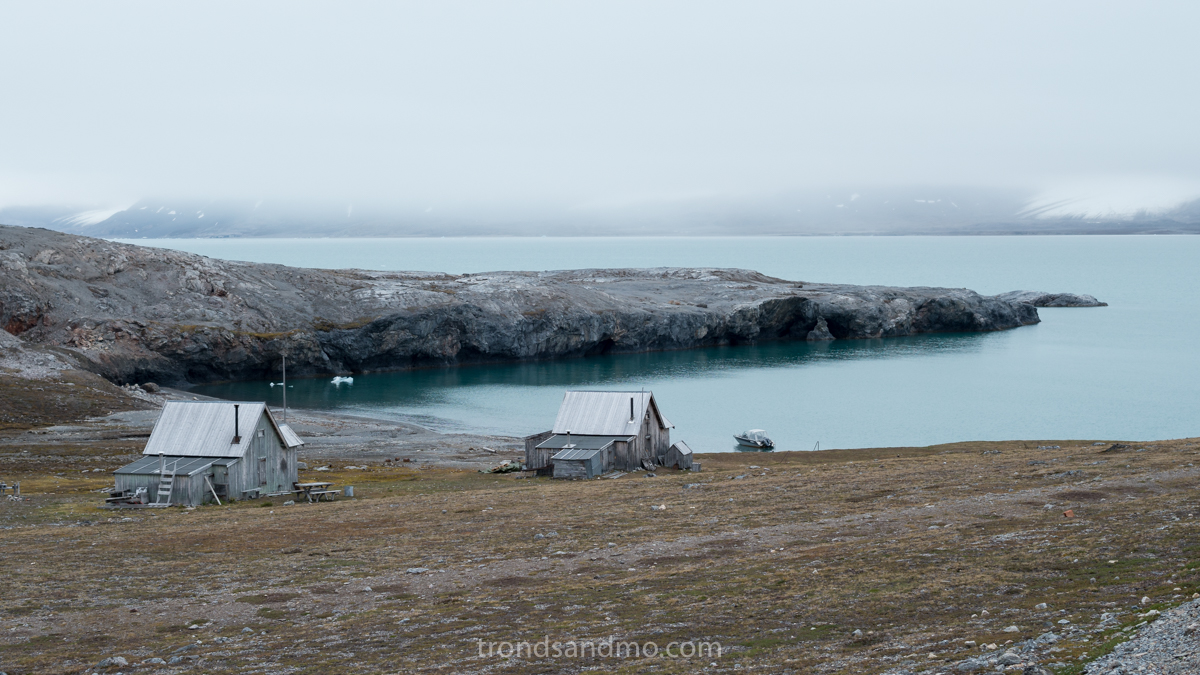
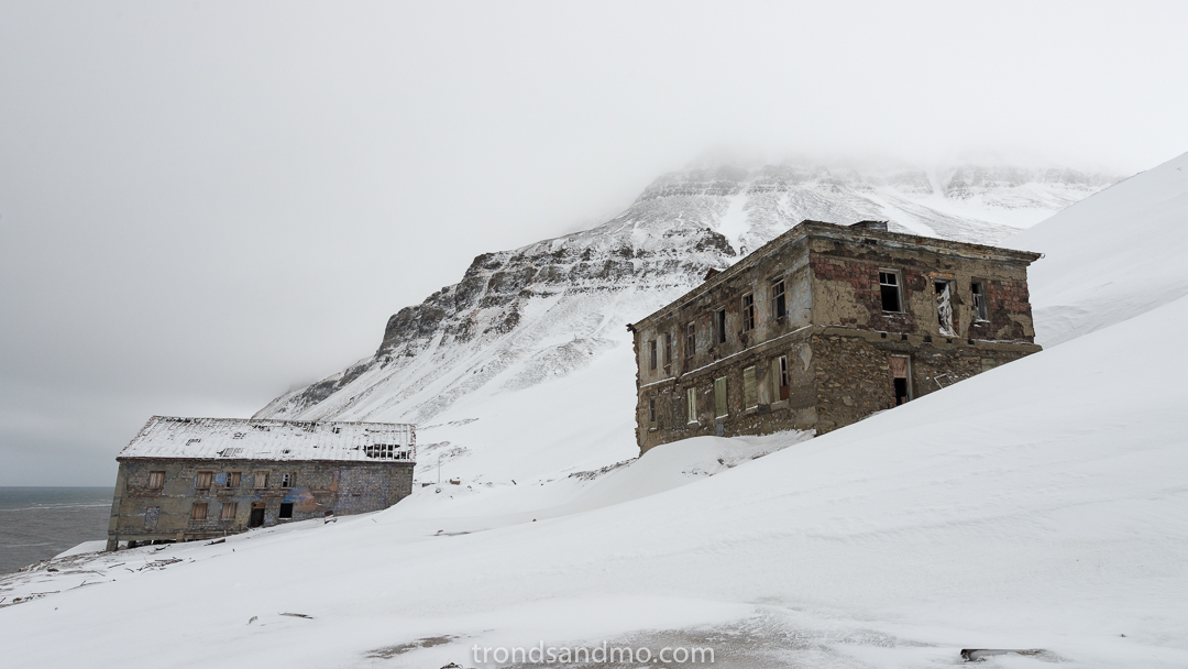
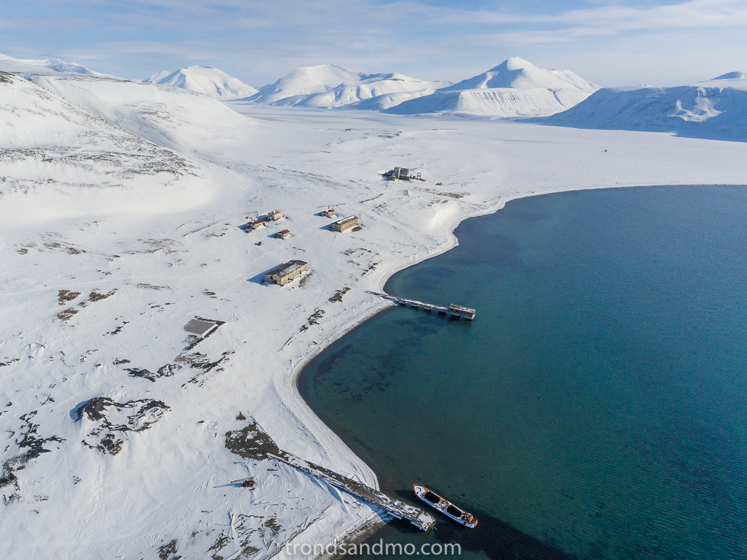
Peirsonhamna. Two remaining houses at London, Svalbard.
The history
The site is located in Kongsfjorden (or Kings Bay in English) on the northwest of Svalbard and is known under several names; London, New London, Ny-London or Camp Mansfield. The Kongsfjord became as early as 1610 discovered by Jonas Poole. Originally he named the fjord Deer Sound. At that time whaling was carried out by Englishmen and Dutchmen in the area. Later, the fjord became known as Koninks Bay (Giles and Rep 1710) and a typing error led to Kings Bay (Scoresby 1820). After the whaling period, the area was mainly used by trappers. Not until the second industrial revolution, New London at Blomstrand Peninsula was explored for resources.
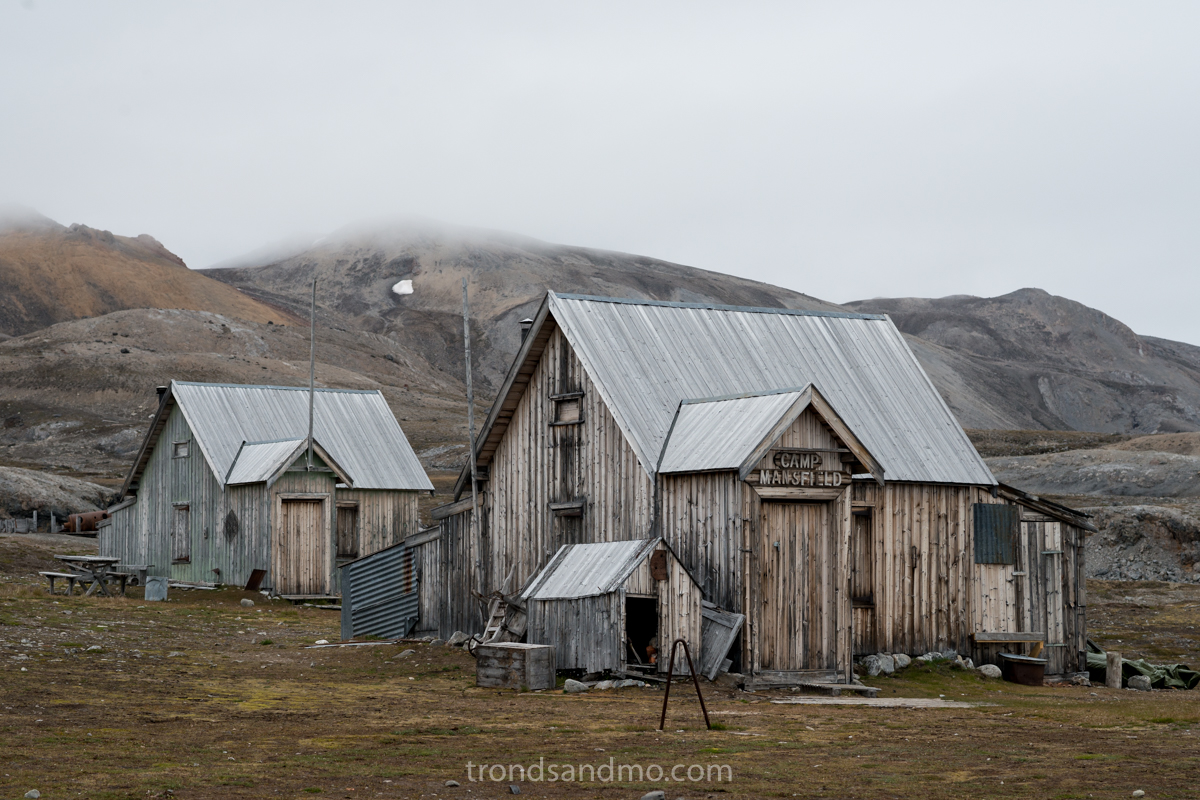
Camp Mansfield, London, Svalbard
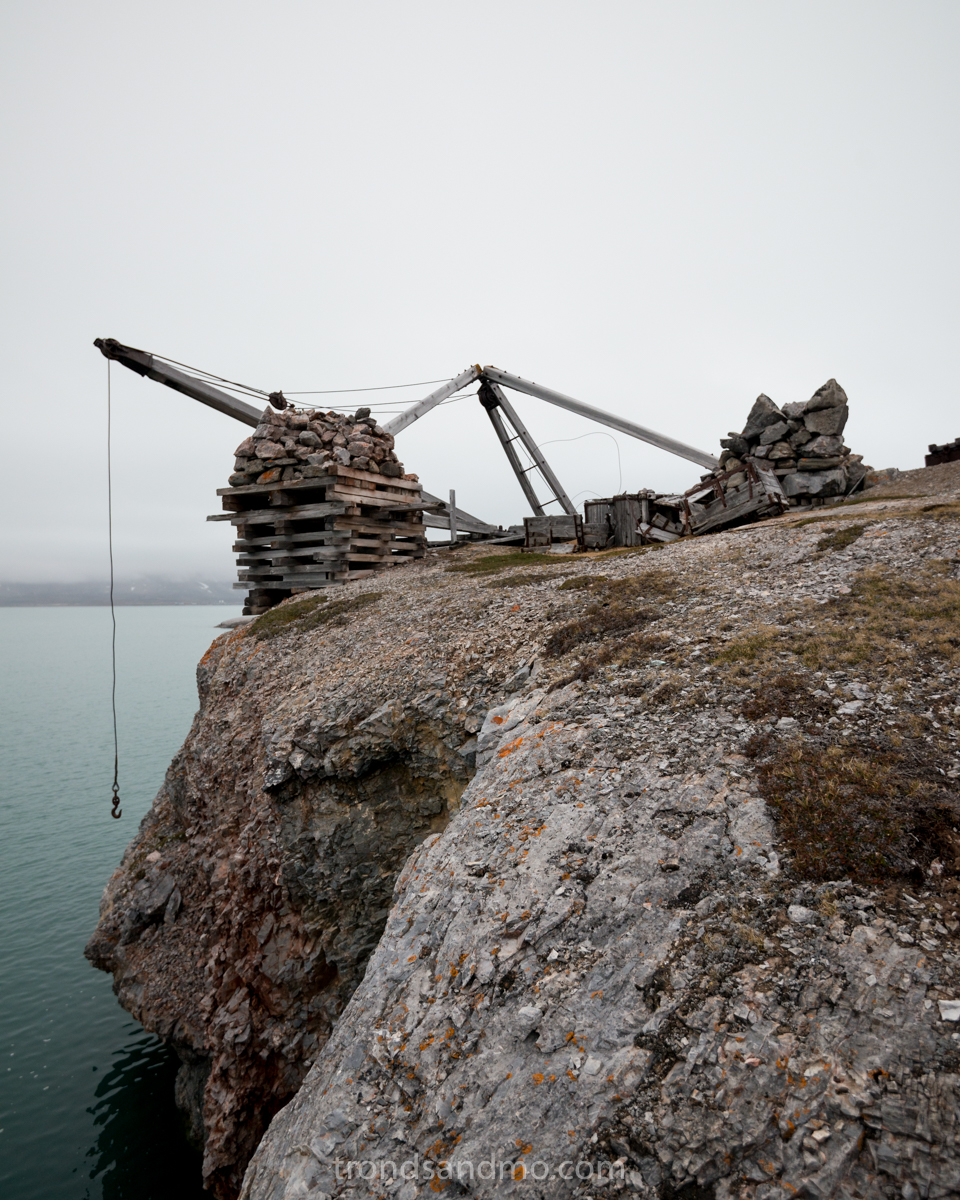
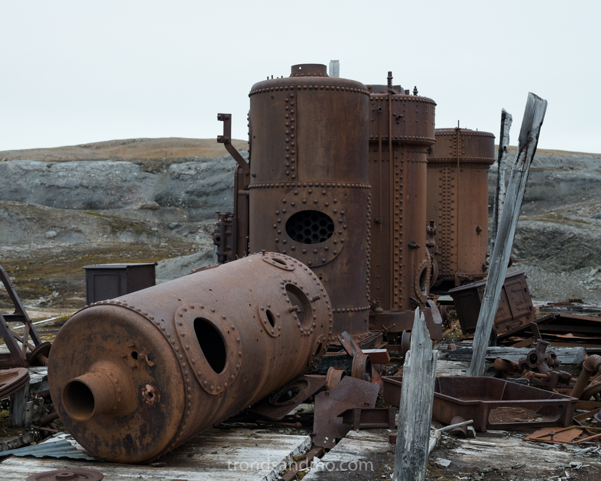
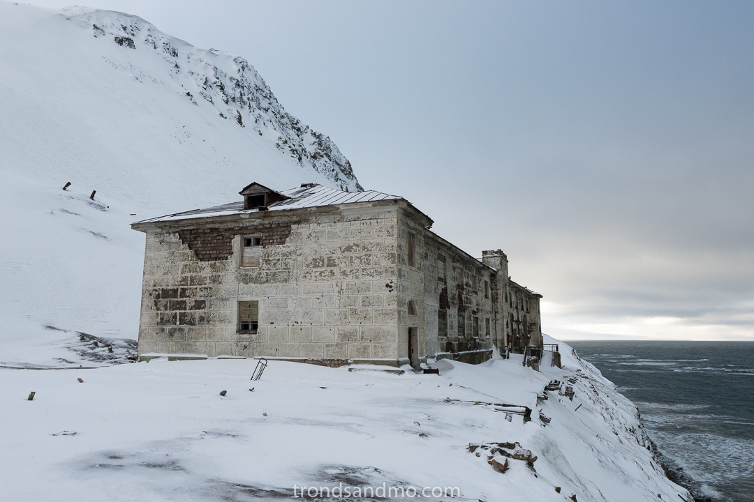
In 1906, marble deposits were discovered by Ernest Mansfield on Blomstrand Peninsula, and the company The Northern Exploration Company ltd started up already in 1911. The facility was quickly set up in subsequent years. Residential buildings, workshops, railways, cranes, steam machines and so on were built on site. Up to 70 people could live and work at the facilities in New London. Not much marble was extracted from the marble quarry, because it turned out that the marble crumbled and was useless. This was probably due to frost action. In 1913, Mansfield was removed from the Northern Exploration Company management and had nothing to do with the company after that. In 1920, the activity in New London was over. The failure was a fact, and equipment and building materials were used elsewhere in Svalbard. For example, several houses were moved to Ny-Ålesund for use in the activity that took place there. The industrial equipment left in New London is among the best preserved from the time before World War I.
What is left at Camp Manfield
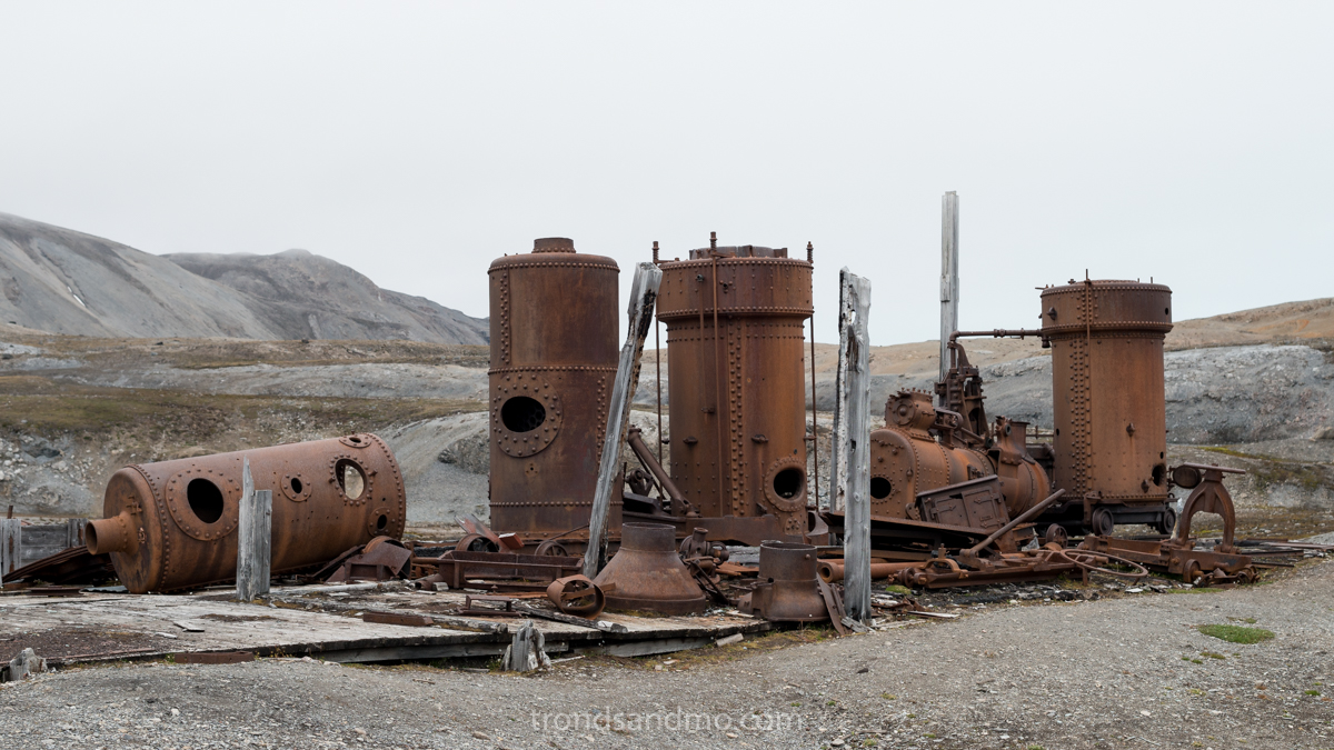
Steam boilers at London, Svalbard
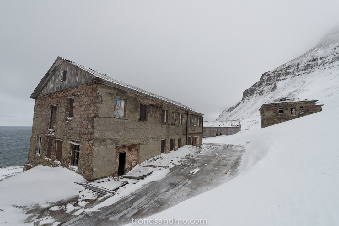
On-sight there are two smaller houses that are in good working order. One is disposed by the welfare of Ny-Ålesund and the other one is used by the Governor of Svalbard. The Governor has field inspectors stationed here during the summer period. Four of the houses have moved to Ny-Ålesund. They are refurbished and used by a company called Kings Bay AS. One also finds remains of steam machines, cranes, and railways. The marble quarry is to be found on the hill above the houses. Three minor sheds are still standing.
There are other buildings associated with the activity in New London: 1) Camp Zoe, located Krossfjorden was set up by Henry Rudi and August Olofson on behalf of Ernest Mansfield in 1911. The cabin is named after Mansfield’s daughter Zoe. Henry Rudi used it for trapping during the winter and served as a watchman. I do not know if The Northern Exploration Company Ltd used the cabin in connection with the operation they had, or if it was only for welfare use. 2) At Storholmen a little further into the Kongsfjord, a house stands and was built in 1911 and used by Mansfield.
Other sites
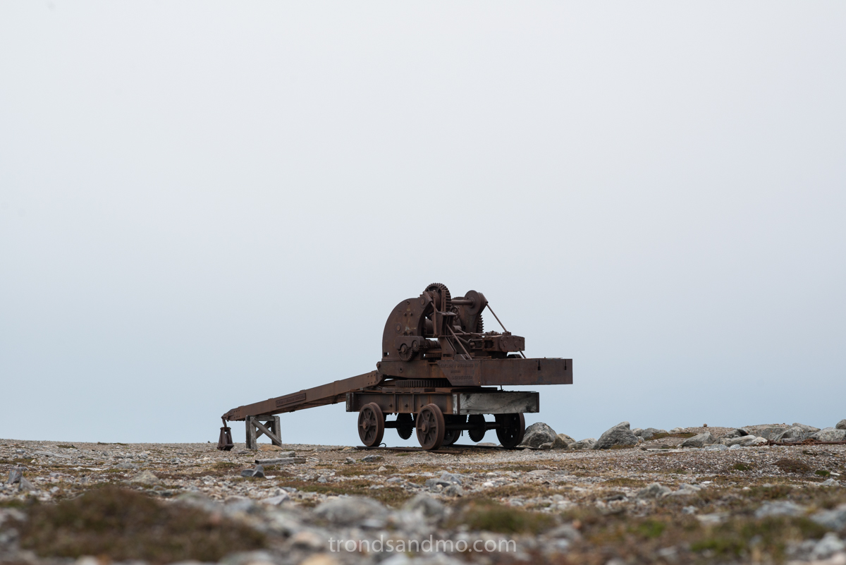
Rail crane at London, Svalbard
Mansfield and The Northern Exploration Company Ltd have been active elsewhere in Svalbard as well. I can mention Camp Morton was established here to exploit coal. There are other places too, however I think I will save them all for another blog post.
As I wrote, Camp Mansfield was built to accommodate 70 people. One can only wonder how they managed. It was certainly a shock for workers who come from UK up to the ice cold Svalbard. I will believe they lived cramped and had long working days. But still it was a pleasure to work for Mansfield. After what I managed to read about him, he was a well-liked man, with good intentions.
How to get there
Peirsonhamna where New-London is located is 5 km north east over the fjord from Ny-Ålesund. The easiest way to travel there is by boat. Actually it is the only way because the Blomastrand peninsula is actually an island. It came for a day when the glacier melted that the peninsula actually was an island. There are regular tourist boats arriving New London, and you can check with your tourist agency. Peirsonhamna is a very good harbor. Had I not known better, I could believe that it had been cut out for the purpose. Boats are protected from the heavy weather that can come from the west.
Tourism
Port crane at Peirsonhamna, London, Svalbard
Such cultural monuments are very exciting to visit, and I understand that tourism is occurring around such places. Unfortunately, tourism has risen enormously in recent decades. Not only in Svalbard, but everywhere. When a cruise ship puts hundreds or, in the worst case, thousands of passengers into vulnerable cultural monuments, it eventually results in wear and tear. I feel this is destructive and want the practice to change for the better. But I think tourism has come to stay and it is up to local politicians to set reasonable limits.
“Take nothing but pictures. Leave nothing but footprints” Is a good rule to follow. These places exist because there was activity in the area and the facilities and location served people a purpose. Today they are a memory of a bygone era. Let us not destroy them or affect them in any way with today’s activity.
In fact, human traces and cultural monuments from the time before 1945 are protected by the cultural heritage laws for Svalbard. Please be careful and show respect for the place.

Wheelbarrow at London, Svalbard

Steam boilers at London, Svalbard
Steam boilers at London, Svalbard
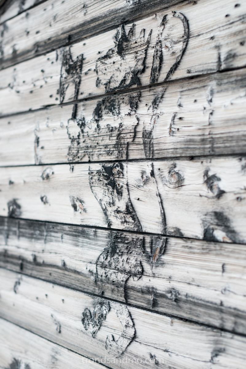
Riksvåpen at London, Svalbard
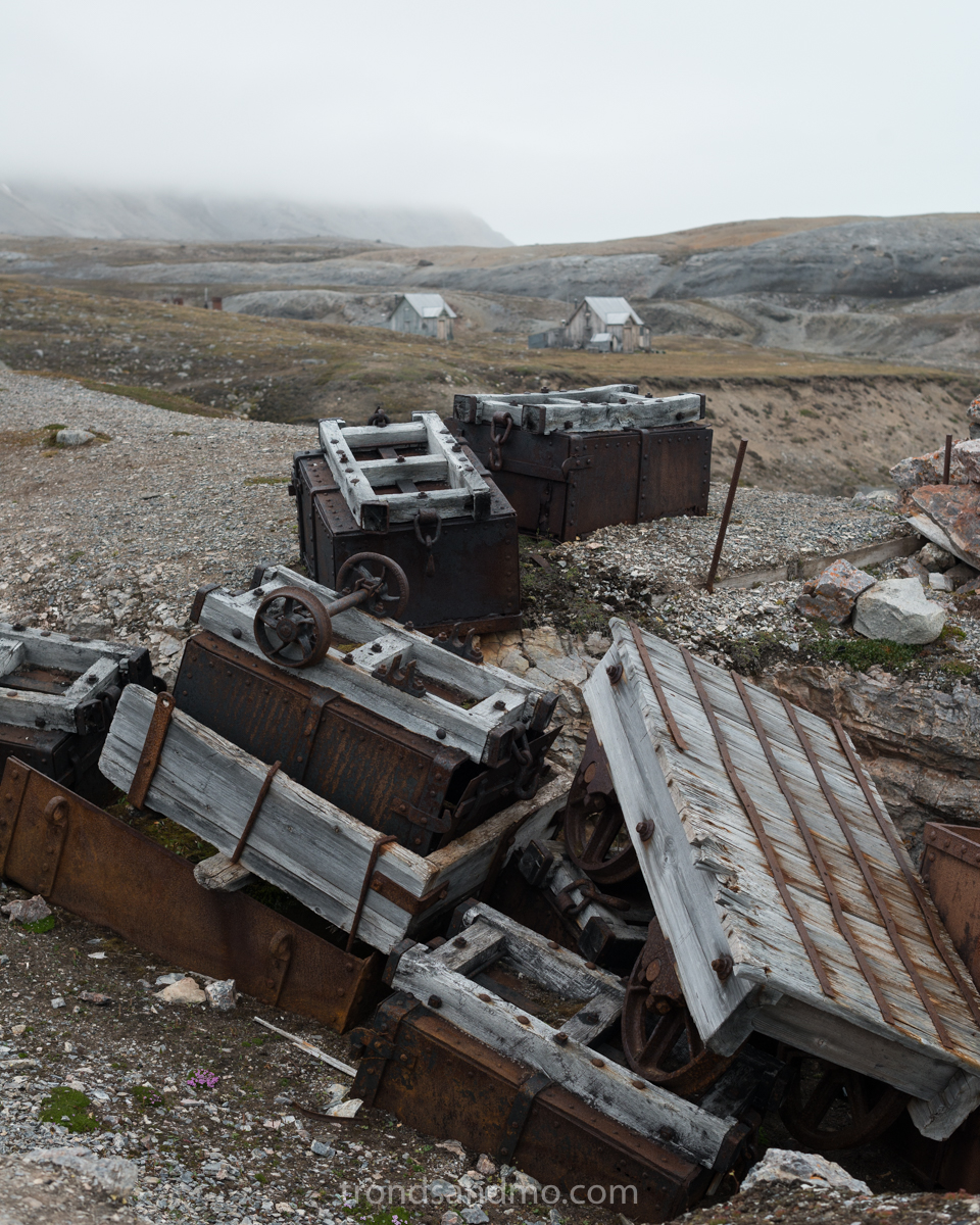
Trolleys at London, Svalbard
Grumant
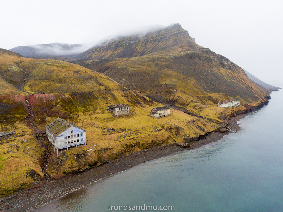
Drone shot III over Grumant / Svalbard
I continue my series about abandoned places here at Svalbard. This time there is also an abandoned Soviet mining town I want to present. Previous post about Coles Bay is closely related to Grumant. And I encourage you to read it first. Urban/Rural exploration is a nice hobby that combines photography and my fascination with abandoned human activity. I urge people to experience these places but to explore carefully and not damage anything.
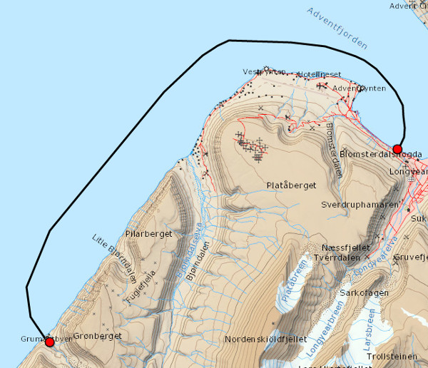
How to get there
Map Grumant Longyearbyen Svalbard
There are no fences around Grumant or other obstacles that keeps you out of Grumant, however the settlement is quite inaccessible. The safest route is probably by boat in the summer time. It is less than 20km one way and should not take long. There is not a particularly good harbor in the area around Grumant, and I recommend that you enter at calm sea. The other routes on foot in summer time and by snowmobile in winter is both dangerous and difficult for most people. I would not describe them here considering what situation people might put themselves in. No liner or regular tours go there. It is best if visitors acquire a local tour guide who is willing to show you Grumant.
What is it
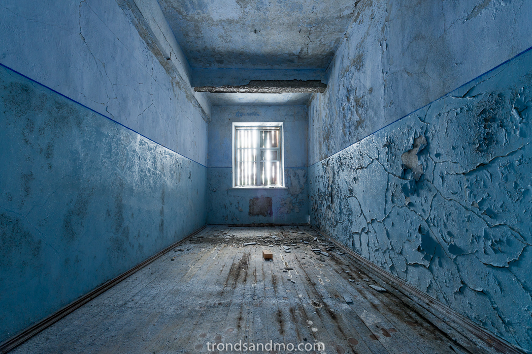
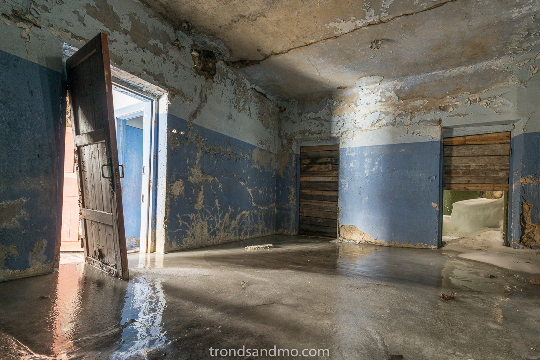
Blue room at Grumant / Svalbard
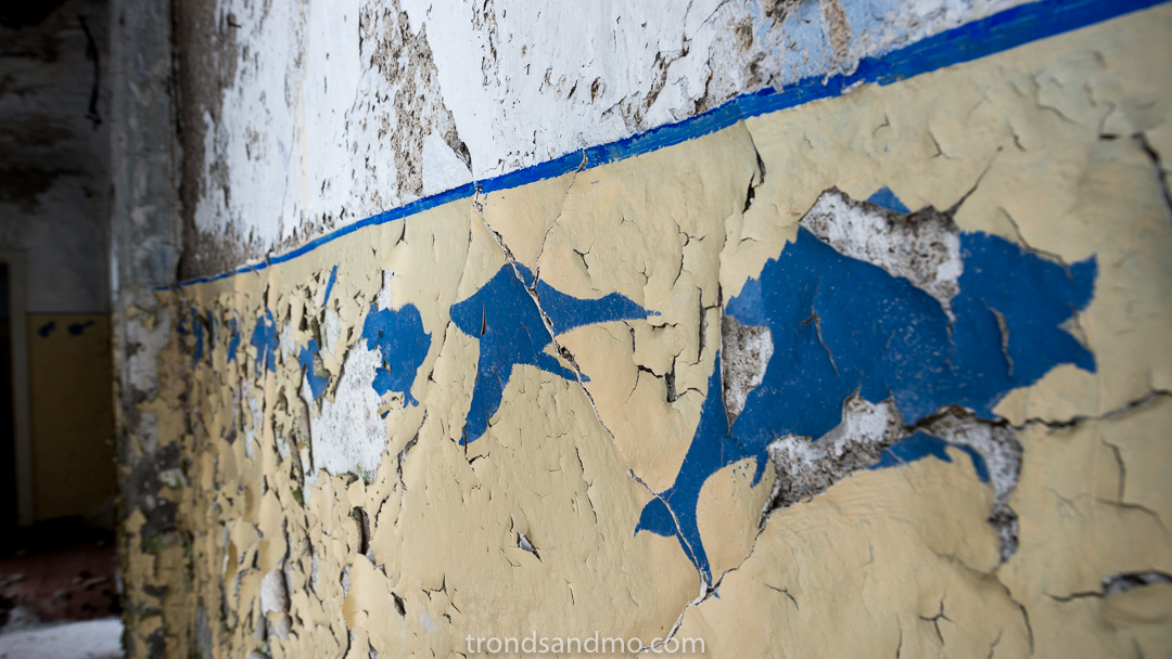
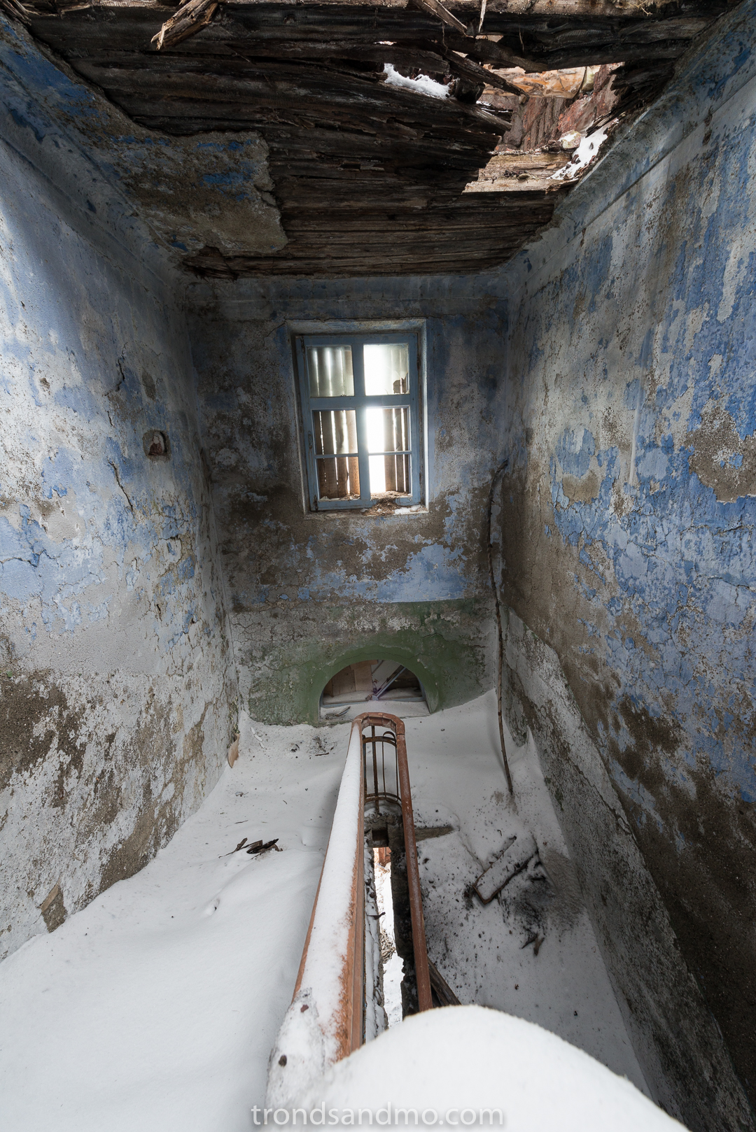
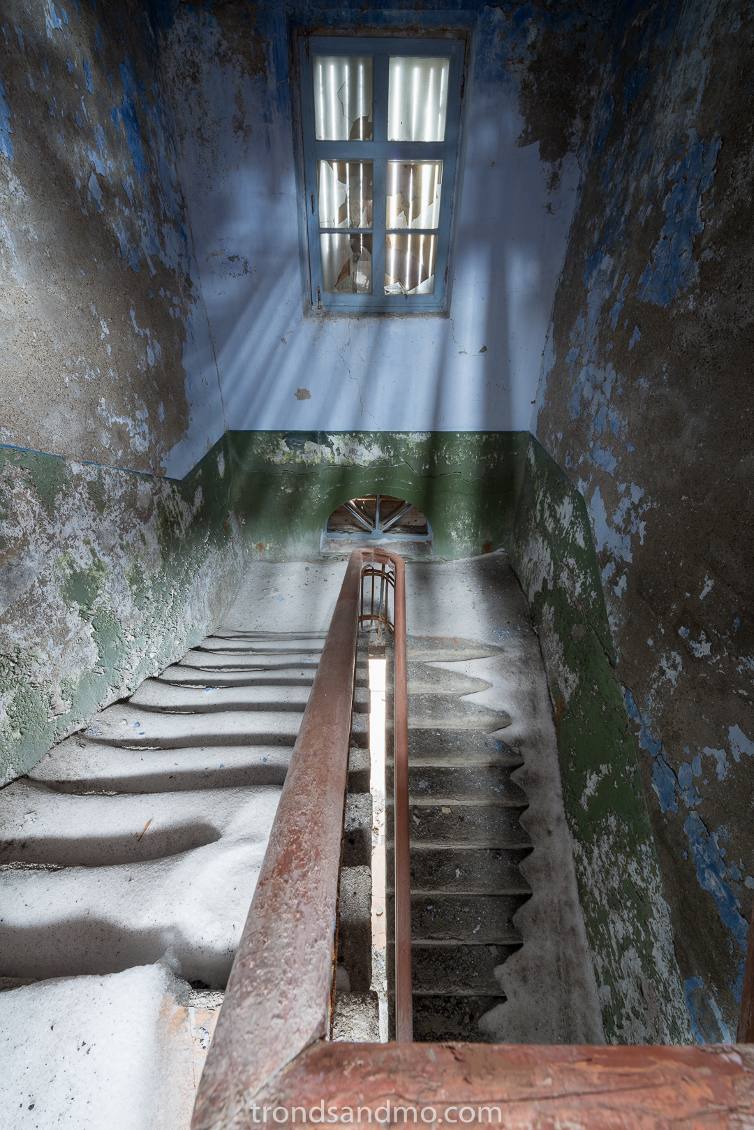
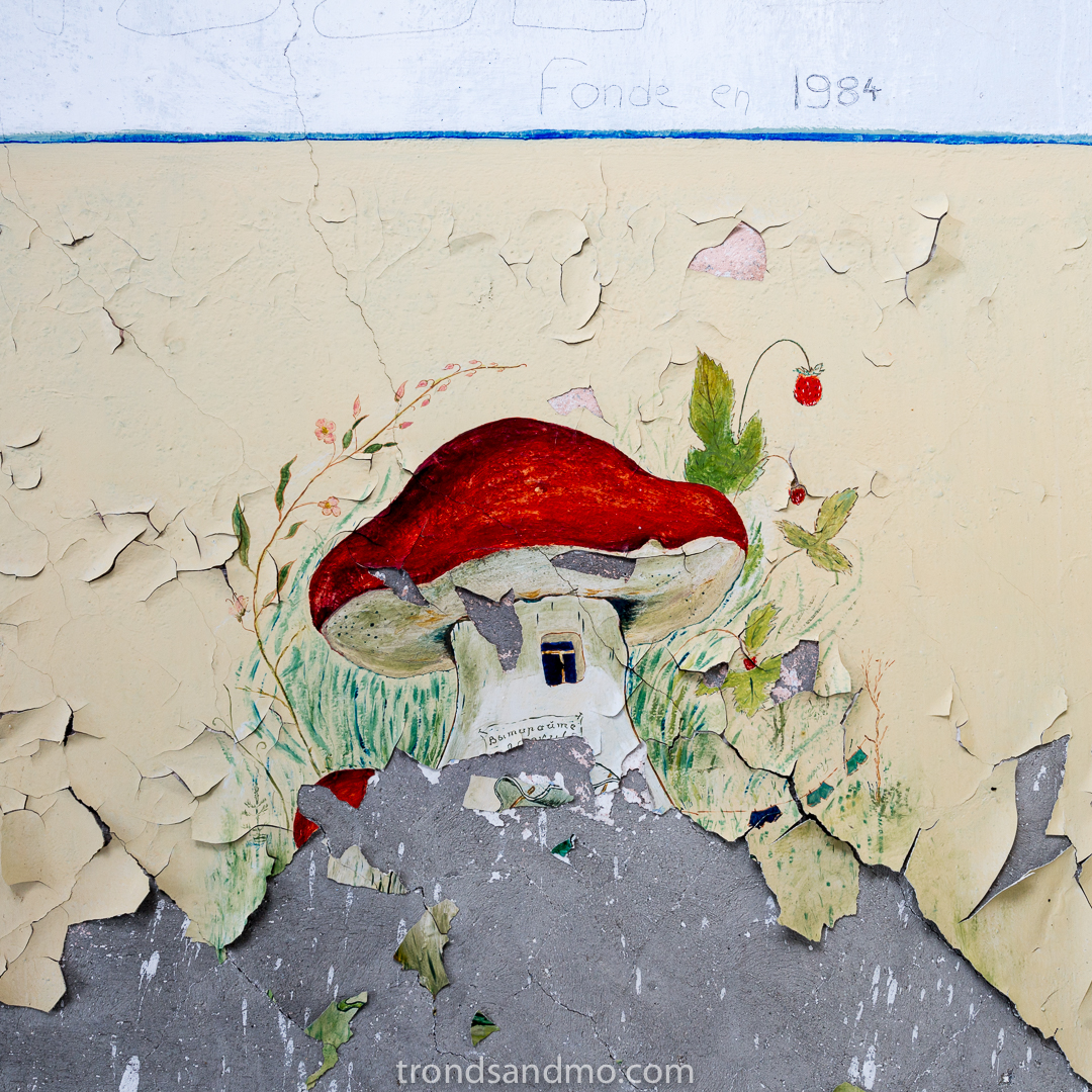
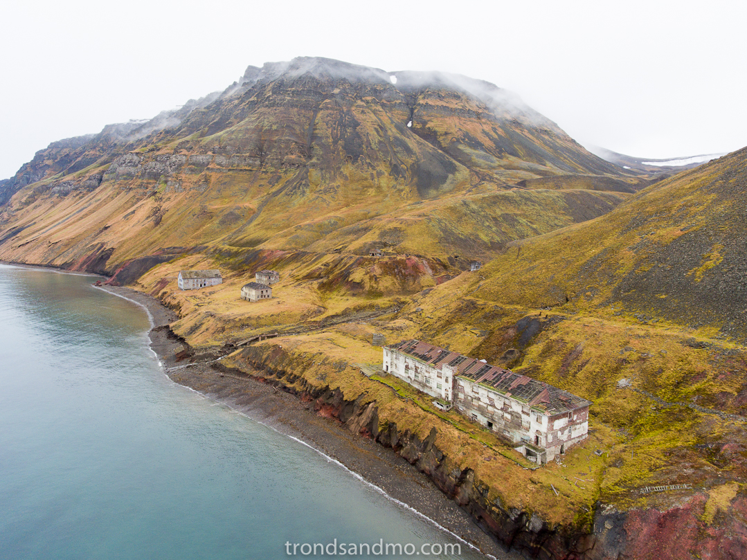
As described in my previous article about Coles Bay, Grumant and Coles Bay was connected by railway. Grumant had a poor harbor and Coles Bay suited much better for shipment of coal and other transport that went by sea. Grumant is a small town between high mountains near the Icefjord, and at the most there were 1,100 residents in the 50s. Grumant had the coal-mine entrances and other buildings with related industrial workplaces. In addition the workers had their living quarters in that narrow valley. I am lucky to have lived in a time that we still could visit the houses and see the beautiful wall paintings and ceiling decorations. It is clear that they had a canteen there and a building for either an infirmary or a kindergarten. Maybe both!
Condition

Wall paintings III. In Grumant / Svalbard
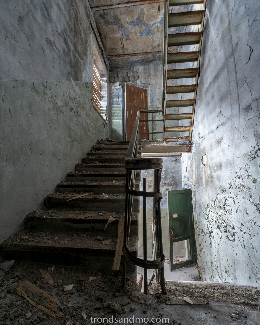
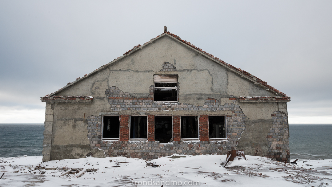
There are not many buildings left in Grumant and those still standing are in a miserable condition. It is especially the severe weather conditions that is the problem. Roofs have collapsed, erosion from the seaside has came dangerously close to the buildings and the permafrost is constantly moving the ground under the houses. Slowly, but surely this destroys the concrete structures in Grumant. Considering the condition I would discourage people to enter in the buildings that still stand.
“Take nothing but pictures. Leave nothing but footprints” Is a good rule to follow. These places exist because there was activity in the area and the facilities and location served people a purpose. Today they are a memory of a bygone era. Let us not destroy them or affect them in any way with today’s activity.
A few shots from Grumant

View over Grumant. Photo taken from Grønberget. Svalbard.
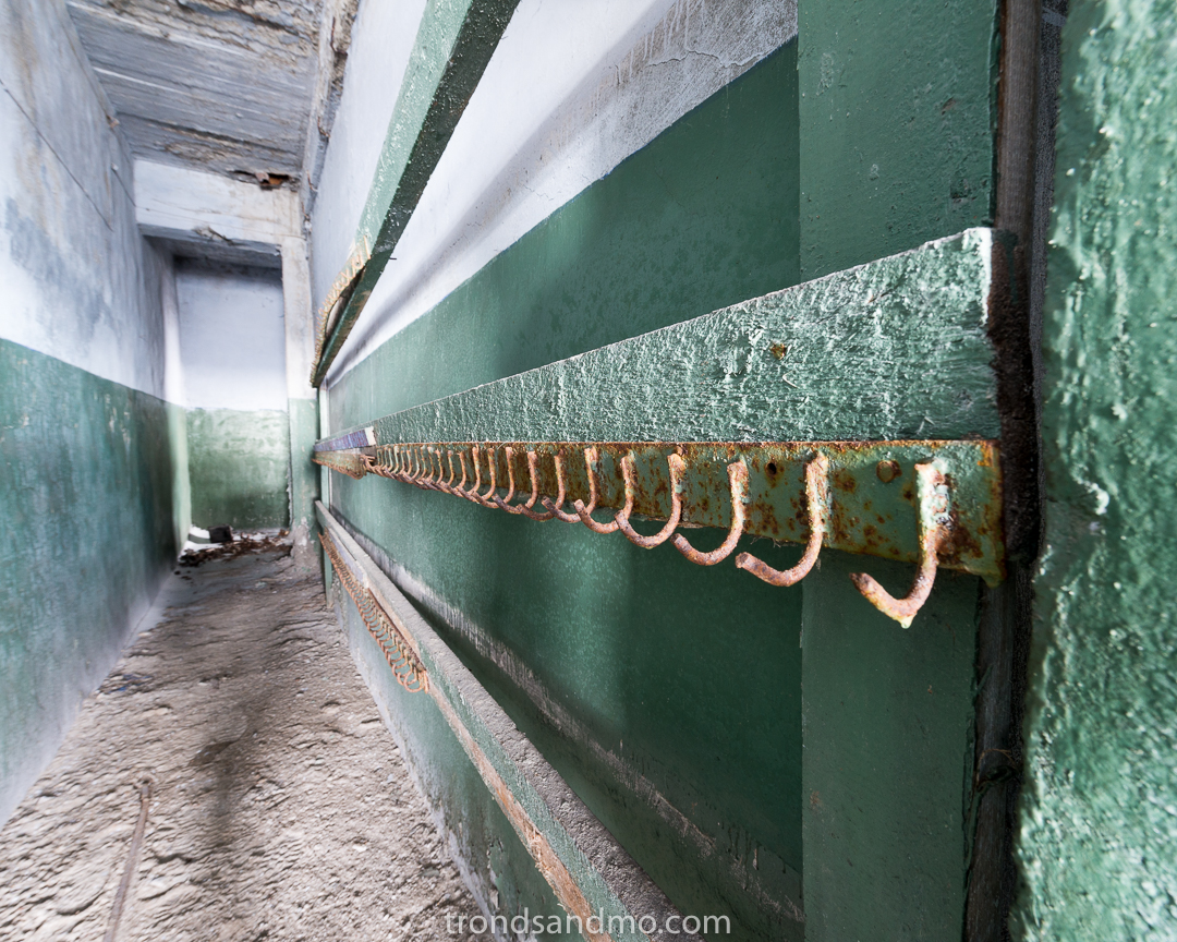
Coat rack at Grumant / Svalbard
Ice on floor. Grumant / Svalbard
Houses at Grumant / Svalbard
Stairway I. At Grumant / Svalbard
Wall paintings I. In Grumant / Svalbard

Drone shot I over Grumant / Svalbard
Houses at Grumant II / Svalbard

Details in the corridor. Grumant / Svalbard
Stairway III. At Grumant / Svalbard

Stairway II at Grumant / Svalbard
Stairway IV. At Grumant / Svalbard
Houses at Grumant IV. Svalbard

Collapsed building. Grumant / Svalbard
Wall paintings II. In Grumant / Svalbard
Drone shot II over Grumant / Svalbard
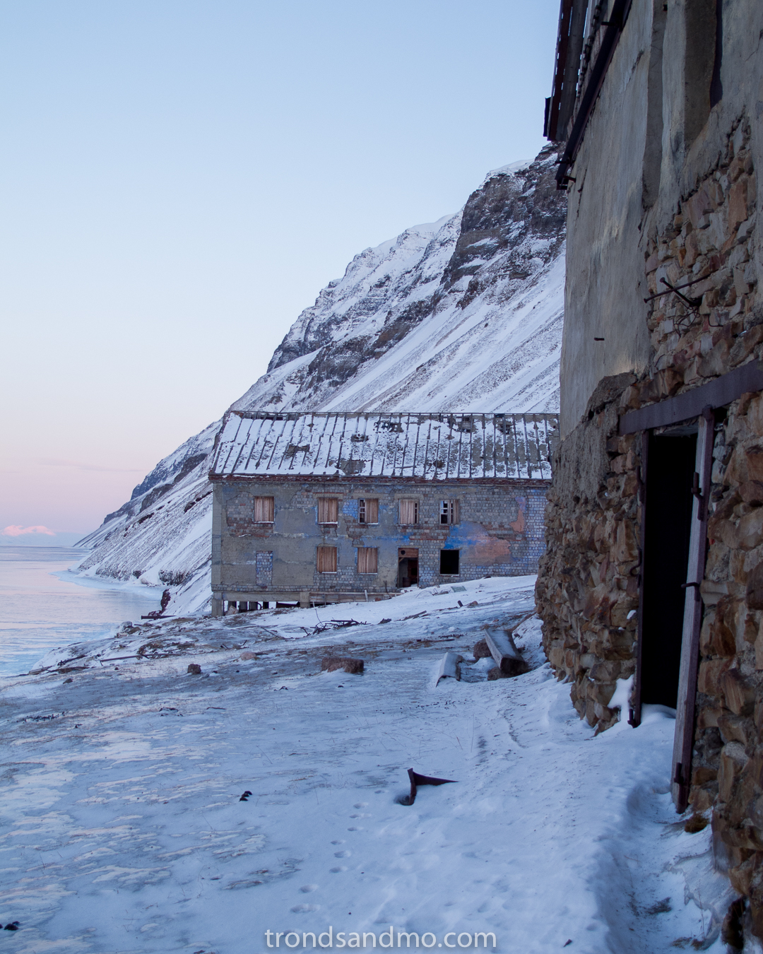
Photo shot at Grumant Svalbard
Houses at Grumant III. Svalbard
Coles Bay
Coles Bay Svalbard. Drone shot
Urban/rural exploration has been a hobby that has given me much joy over the years. Both the historical aspect of it and the joy of taking pictures and documenting old ruins. Svalbard has many such places, and I thought it was a good idea to introduce them here. Maybe others will have an interest in visiting these places as well? Coles Bay is one of the abandoned settlement that is easiest to visit, and I thought to introduce it first.
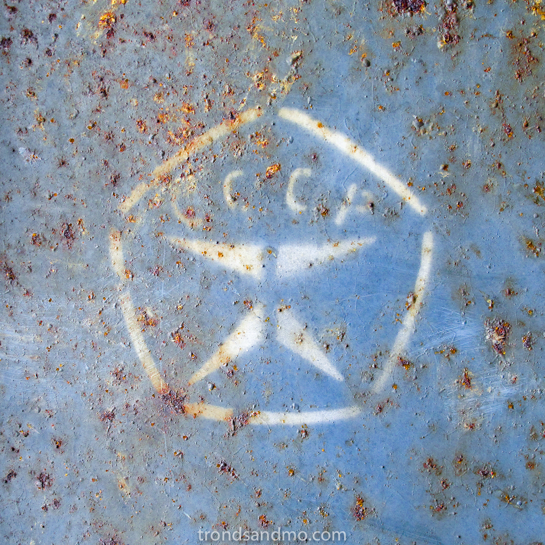
CCCP detail found at Coles Bay Svalbard. The russian abbreviation for USSR.
What is it: Coles Bay area has a history of Norwegian trappers dating back to 19th century, but the buildings and ruins we see today stems from the Soviet mining operations that came later in the 20. century. Coles Bay and Grumant further north was linked by railways. Coles Bay had a good harbor and functioned as an export port for the Grumant settlement. Grumant and Coles Bay had a total of over 1,100 inhabitants at its peak in 1951-1952.
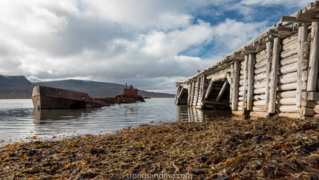
Shipwreck at port of Coles Bay Svalbard
What to explore: In the area there are about 10 to 12 large and small buildings that are more or less intact. Several ruins can also be seen in the area. There are two ports in Coles Bay and at one of them lies a shipwreck half sunk. Traces of the old railway is seen north-west of town going toward Grumant. The old power plant and the graveyard is seen in easterly direction from the main buildings.
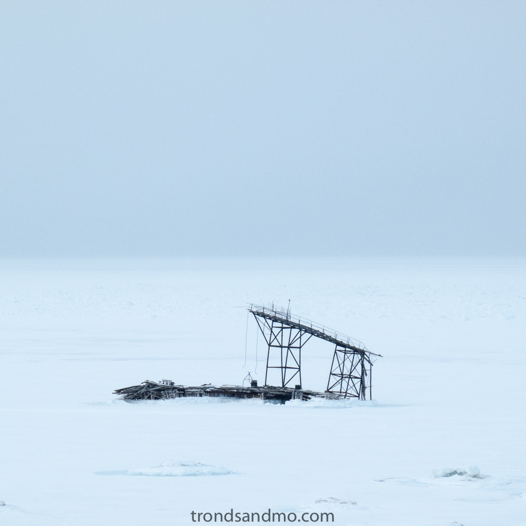
Remains of Coles Bay Svalbard. These structures are lost in the bay, and not visible anymore.
Condition: Most buildings have roofs intact but may have such a state that those are not recommended to enter. Some houses have locked doors and windows in good condition, while the other houses are open. Intrusion by force to closed buildings is not ok.
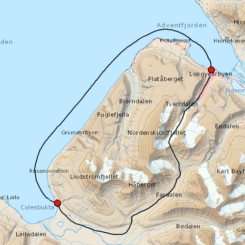
Map showing route between Longyearbyen and Coles Bay.
How to get there: You can travel to Coles Bay with either boat in the summer time or snowmobile in the winter time. Coles Bay has a good harbour and is a safe lie in. The trip from Longyearbyen by boat is approximately 25 kilometers one way. No liner go there ohwever regular tours go there in winter time. In winter you can travel with snowmobile over the mountains near Longyearbyen and down Colesdalen. Also about 25 km one way. It is recommended to travel with a local guide to get to Coles Bay. Hiking between Longyearbyen and Coles Bay is not recommended. At least not for people without mountain experience.
“Take nothing but pictures. Leave nothing but footprints” Is a good rule to follow. These places exist because there was activity in the area and the facilities and location served people a purpose. Today they are a memory of a bygone era. Let us not destroy them or affect them in any way with today’s activity. Be careful.
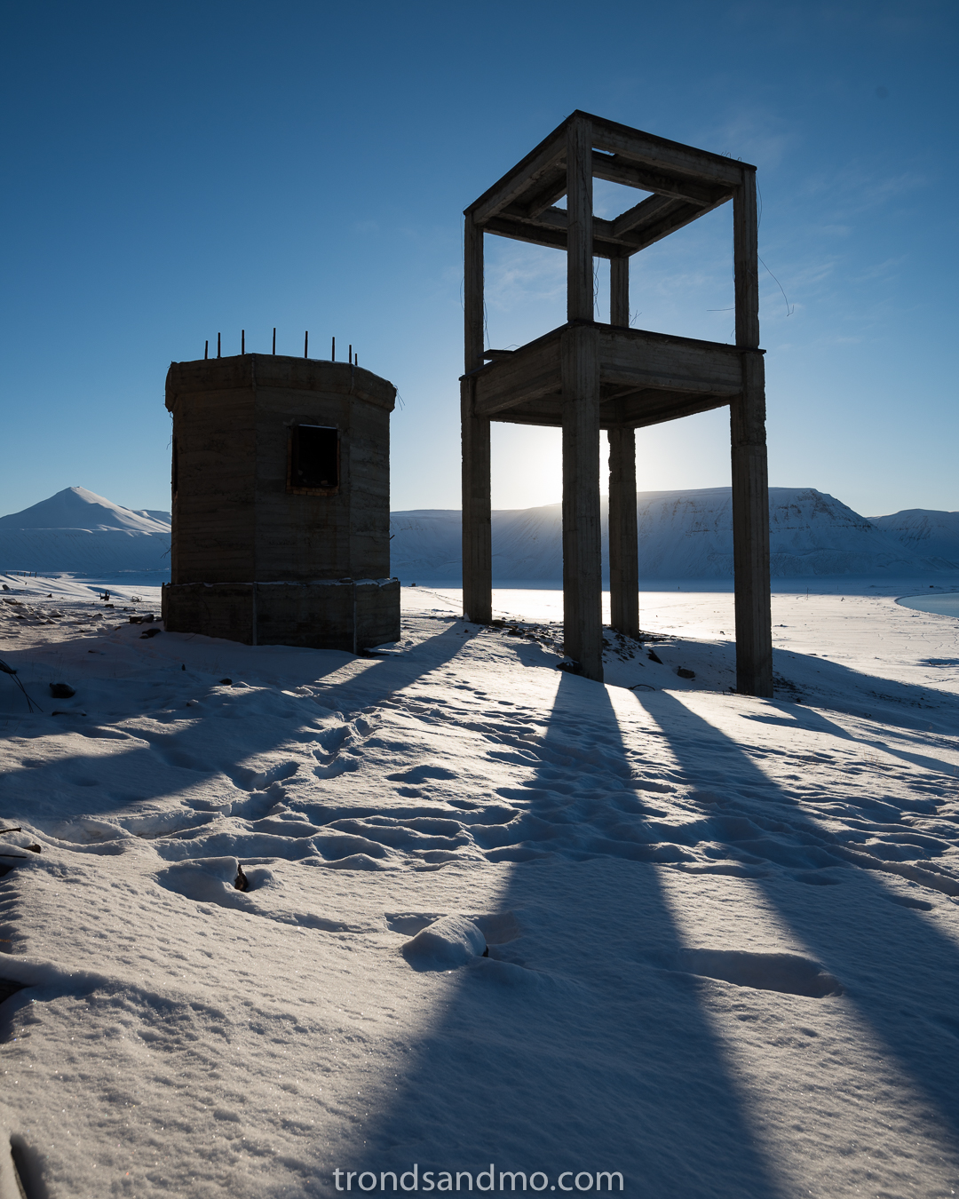
Concrete structures in Coles Bay Svalbard

Coles Bay Svalbard. Drone shot
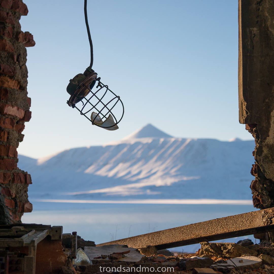
Broken. Detail from ruins at Coles Bay Svalbard. Mountain in background is called Vesuv.